Covered Bridge Tour Northern Route
Covered Bridge Tour Northern Route
1 hour 45 minutes long
50 miles
Please note: Pulp Mill Bridge has divided lanes; Hammond Bridge and Shoreham Covered Railroad Bridge are open to foot traffic only.
Start at the Brandon Visitor Center at 4 Grove St. (Route 7).
Turn right (south) out of the driveway
Mile point
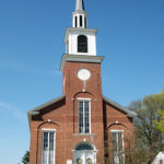
0.2 Turn right on Champlain St. (Route 73 West) by the Baptist Church next to the Visitor Center
5.4 Turn right on Sawyer Needham Road
7.4 At the stop, turn left on Leicester-Whiting Road
9.2 Continue straight across Route 30 onto Shoreham-Whiting Road
12.2 Turn left on Shoreham Depot Road
12.9 Turn right at the Dept. of Fish and Wildlife Richville Covered Bridge Access Area for the
Shoreham Covered Railroad Bridge – Shoreham
This bridge is open to foot traffic only. It was built in 1897 and is a Howe type of construction. The bridge crosses Richville Pond (an impoundment of the Lemon Fair River) and belonged to the former Addison Branch of the Rutland Railroad. This covered bridge is listed on the National Register of Historic Places. It’s interesting to see how much taller this bridge is, considering the trains it had to accommodate.
Returning to Shoreham Depot Road, turn left.
13.6 Turn right back onto Shoreham-Whiting Road.
16.3 At Whiting Center turn left on Route 30 North
20.0 Turn right onto Swamp Road
21.8 Site of Cornwall-Salisbury Covered Bridge – Cornwall
(Also known as Creek Road Bridge, Cedar Swamp Bridge, Salisbury Station Bridge, and Station Bridge)
Built in 1865 of the Town lattice truss style, this bridge belonged notably among of Vermont's rare covered bridges crossing town lines. The bridge was destroyed by fire on September 10, 2016, and is currently replaced by a metal, single lane, temporary bridge. From here continue east.
22.5 Turn left on West Salisbury Road
23.1 At the stop, turn left on Shard Villa Road, passing the impressive architecture of Shard Villa, currently a residential care facility, but having an interesting history worth researching.
26.3 Turn right on 3 Mile Bridge Road
27.4 At the stop, turn left on Route 7 North and continue through Middlebury
32.0 At the light, by the Mobil Station, turn left on Elm Street, and at the stop continue straight under the railroad trestle then bear right, still on Elm Street
32.7 Pulp Mill Bridge – Middlebury and Weybridge
This bridge, built between 1808 and 1820, is in the Burr arch style and crosses Otter Creek. Unique among the covered bridges on this tour, Pulp Mill is a two lane divided bridge. Listed on the National Register of Historic Places, Pulp Mill Bridge is also notable for the pedestrian bridge on the south side. While many of the other bridges on the tour have openings to see out, you’ll have to appreciate your view of the river from the walking bridge.
32.8 Beyond the bridge, at the fork, turn left on Pulp Mill Bridge Road
33.2 At the stop, turn left on Route 23 East (Weybridge Street)
33.9 At the stop, go straight toward Route 30
34.0 Turn left on Route 30 North
34.1 At the roundabout, take the first right toward Route 7 and over the Court Street Bridge
34.4 At the light, turn right onto Route 7 South and continue approximately 16 miles to Brandon.


